🚚 Free Worldwide Shipping on All Orders!Shop Now
Map of the Alluvial Region of the Mississippi, 1861
This beautiful antique map reproduction is printed on heavy acid-free stock with fade proof inks and is excellent for framing.
Copyright 1861
Size: 19" × 30"
Product Information
Product Information
Shipping & Returns
Shipping & Returns


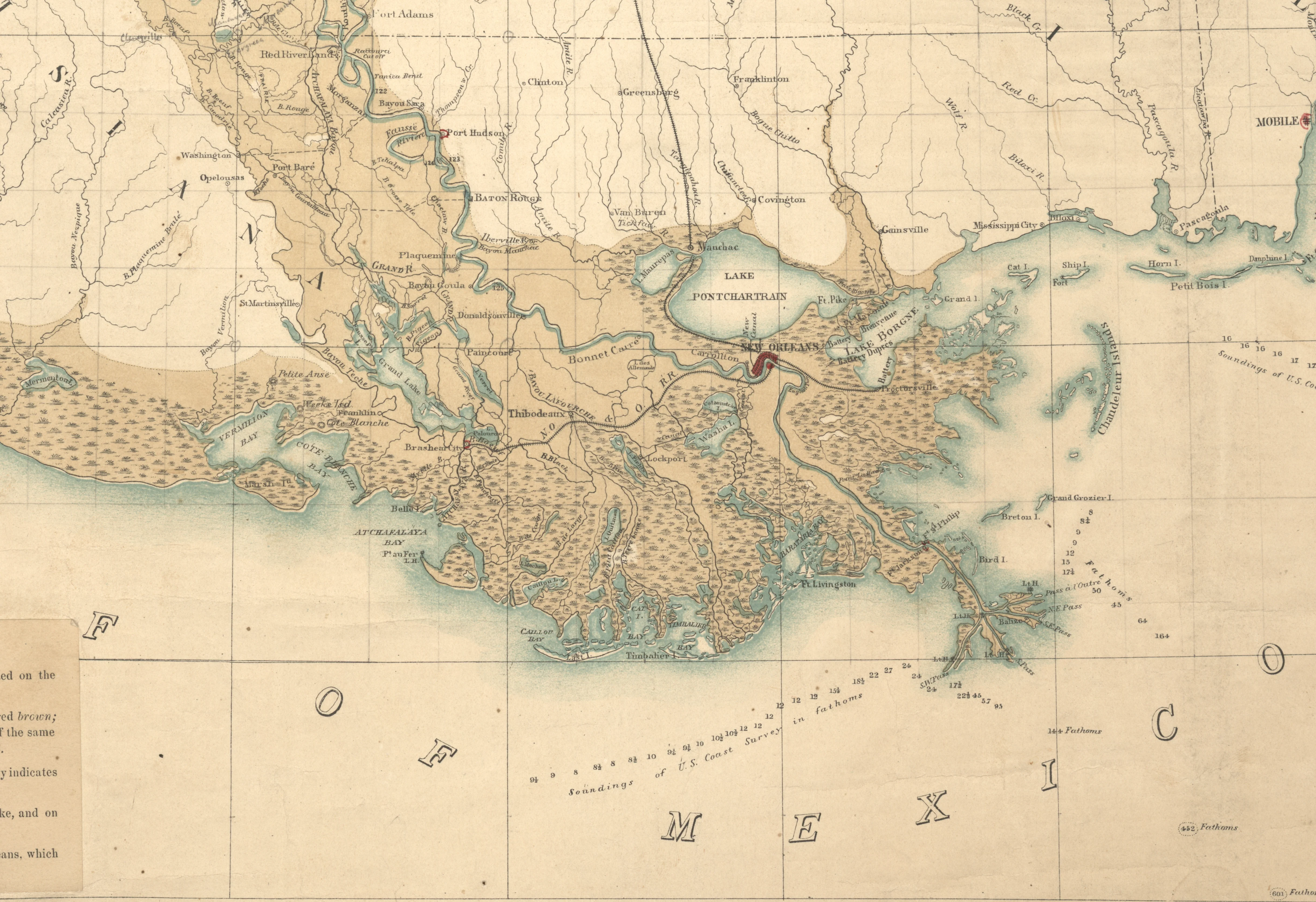
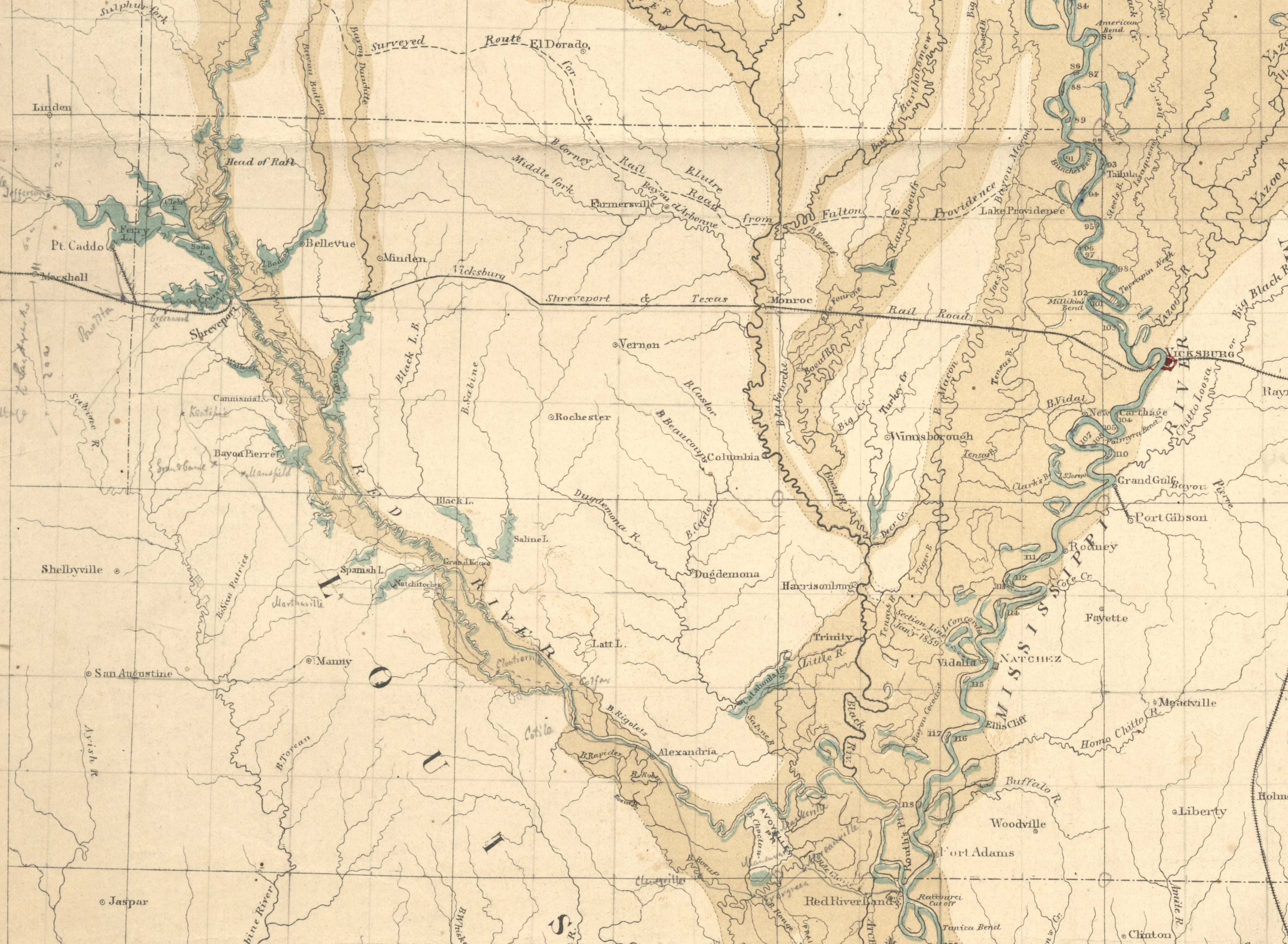
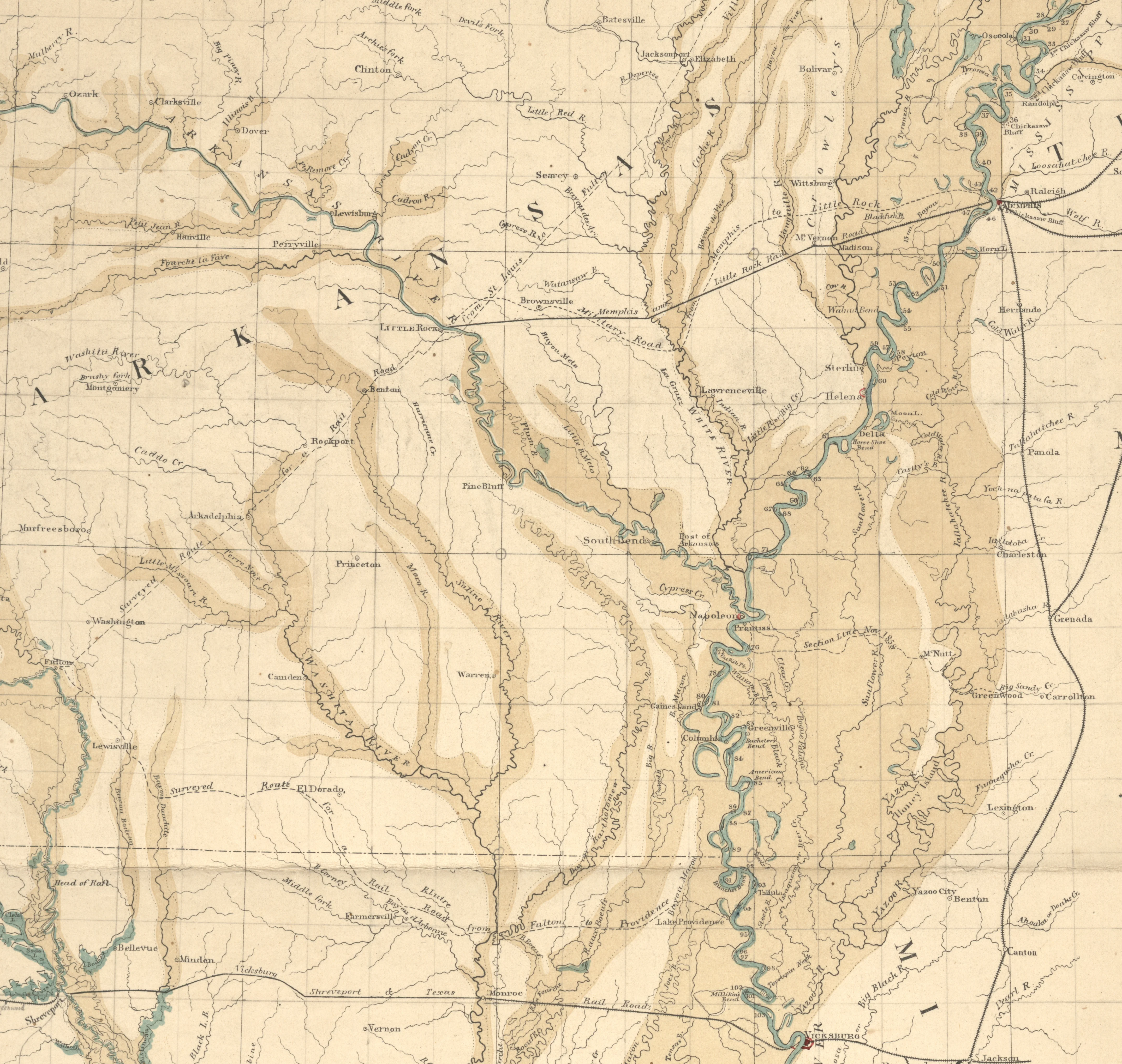
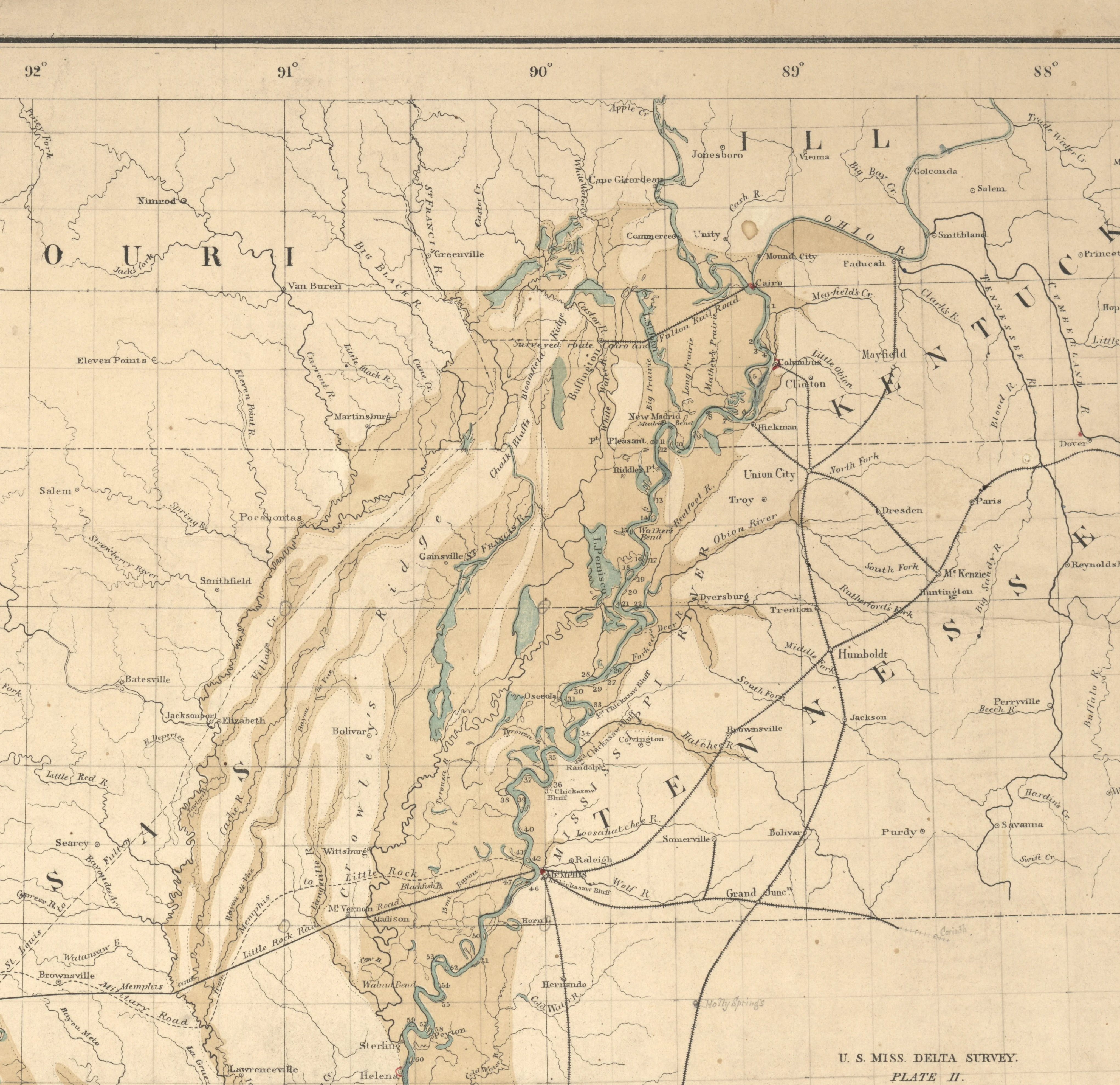
Map of the Alluvial Region of the Mississippi, 1861
Map of the Alluvial Region of the Mississippi, 1861
This beautiful antique map reproduction is printed on heavy acid-free stock with fade proof inks and is excellent for framing.
Copyright 1861
Size: 19" × 30"
$39.95
Map of the Alluvial Region of the Mississippi, 1861—
$39.95
Product Information
Product Information
Shipping & Returns
Shipping & Returns
Description
This beautiful antique map reproduction is printed on heavy acid-free stock with fade proof inks and is excellent for framing.
Copyright 1861
Size: 19" × 30"


