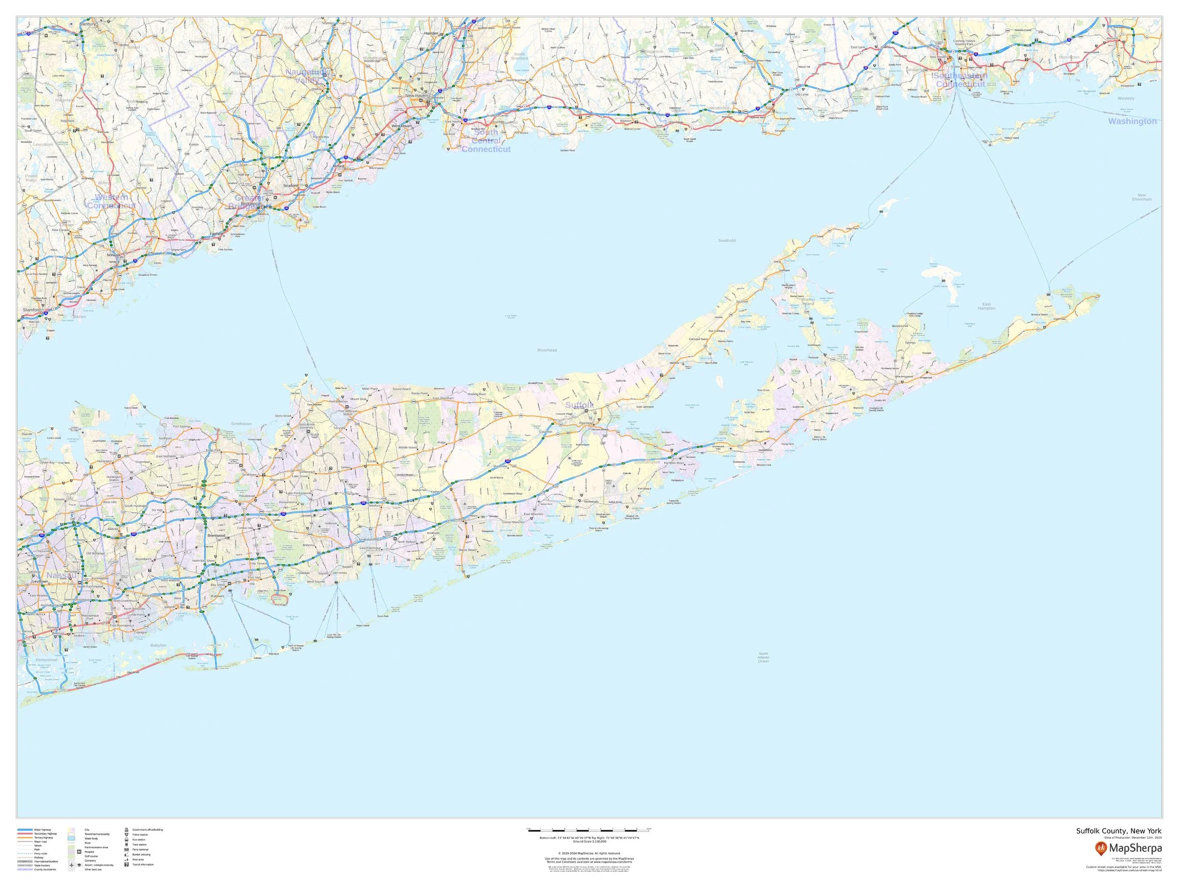
Long Island Wall Map
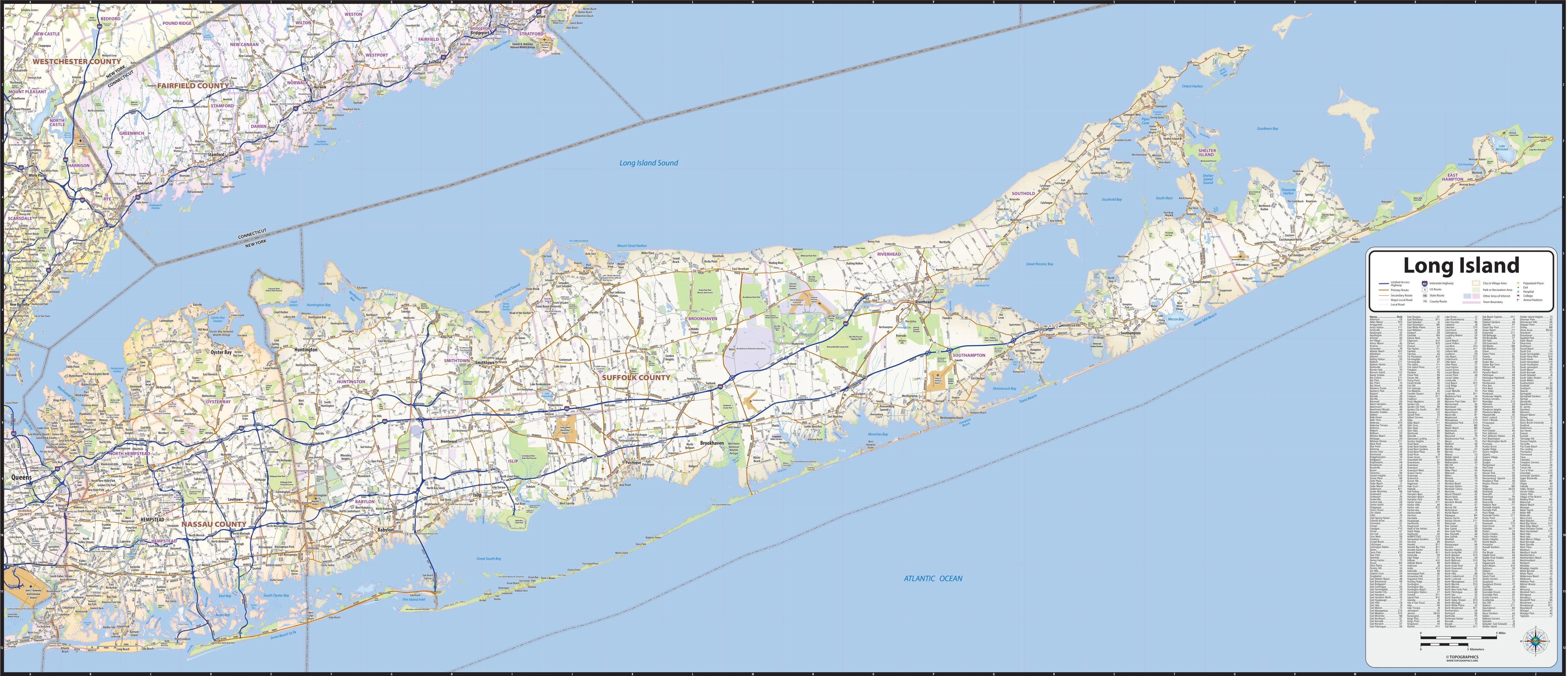
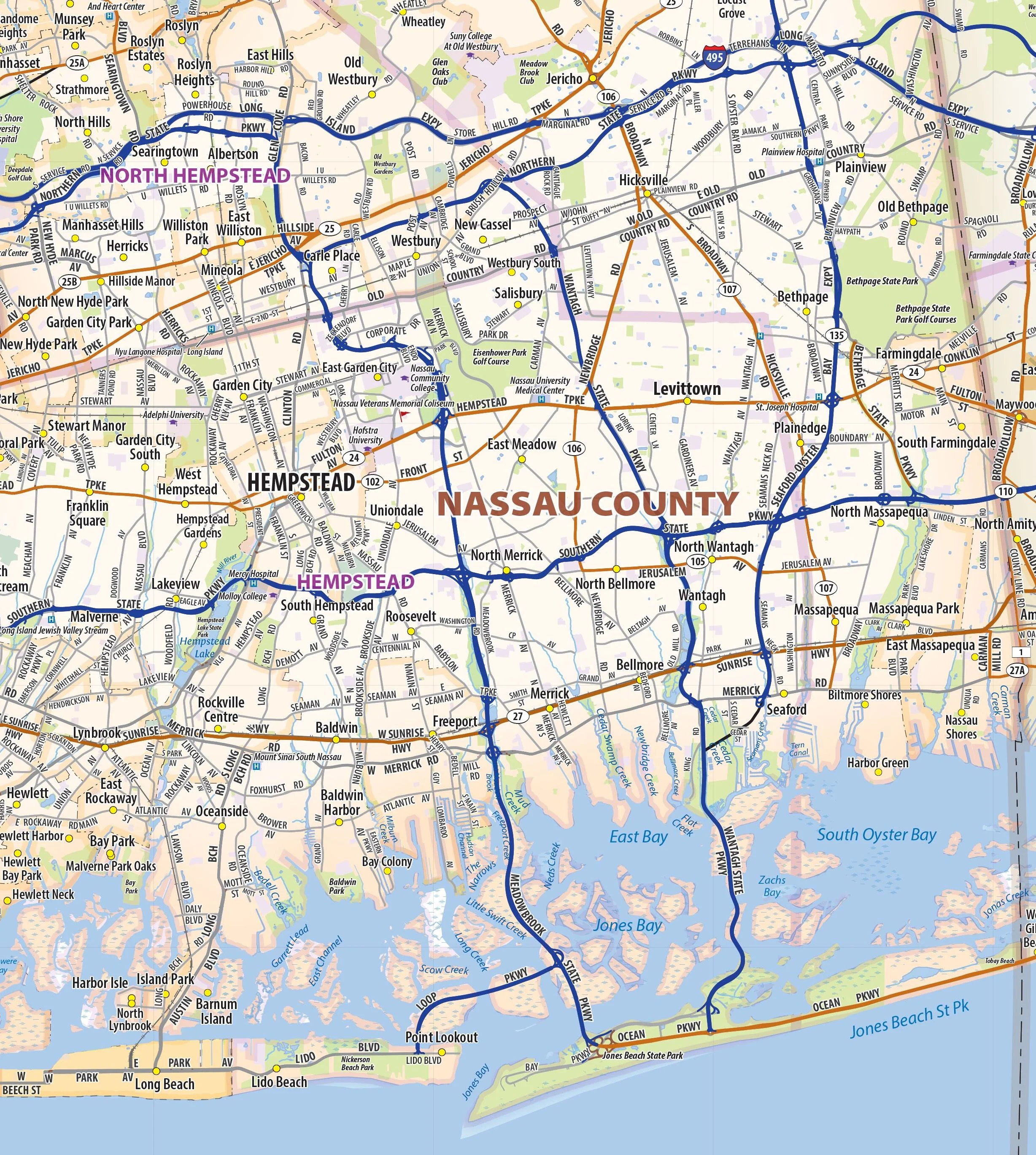
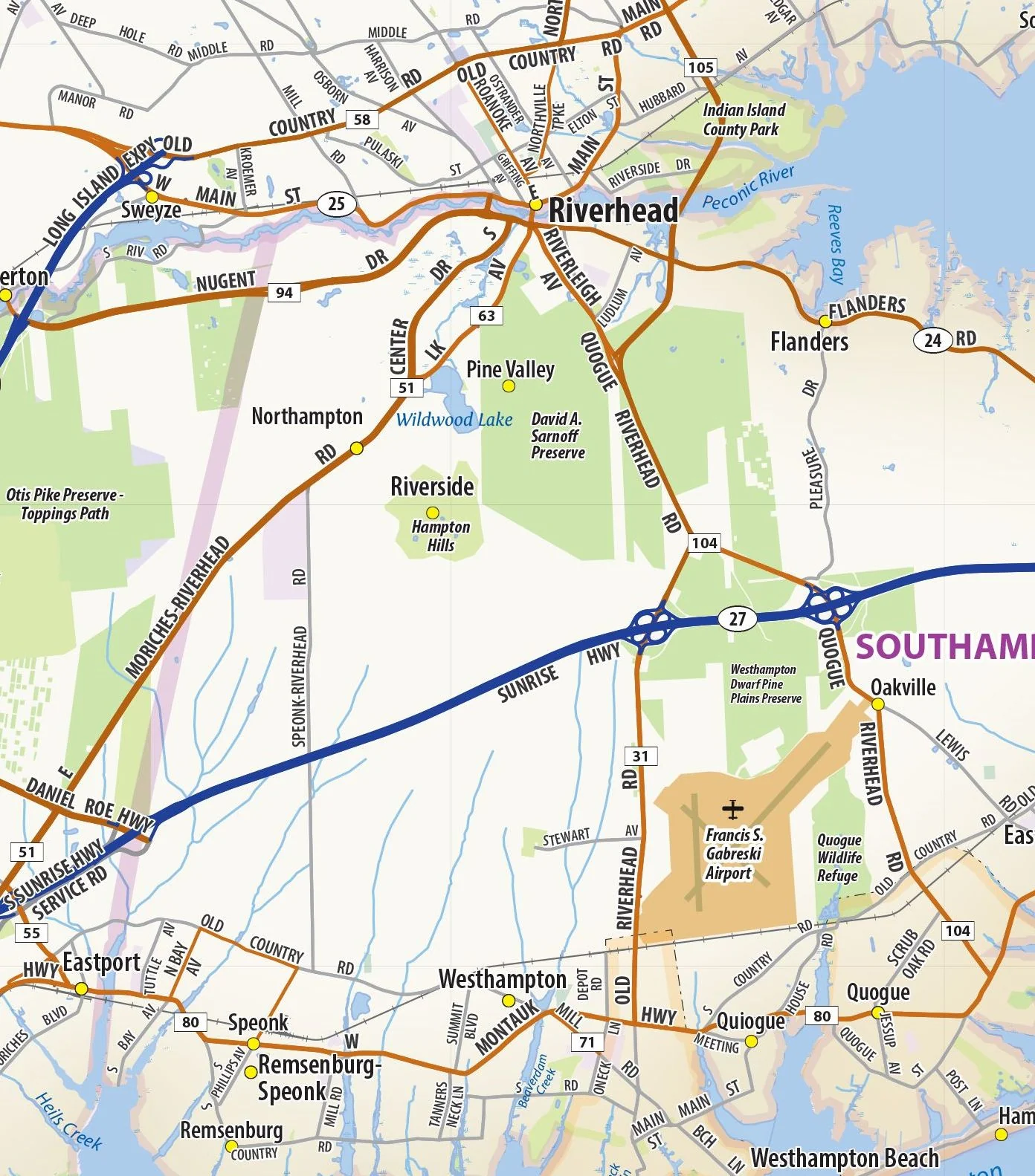
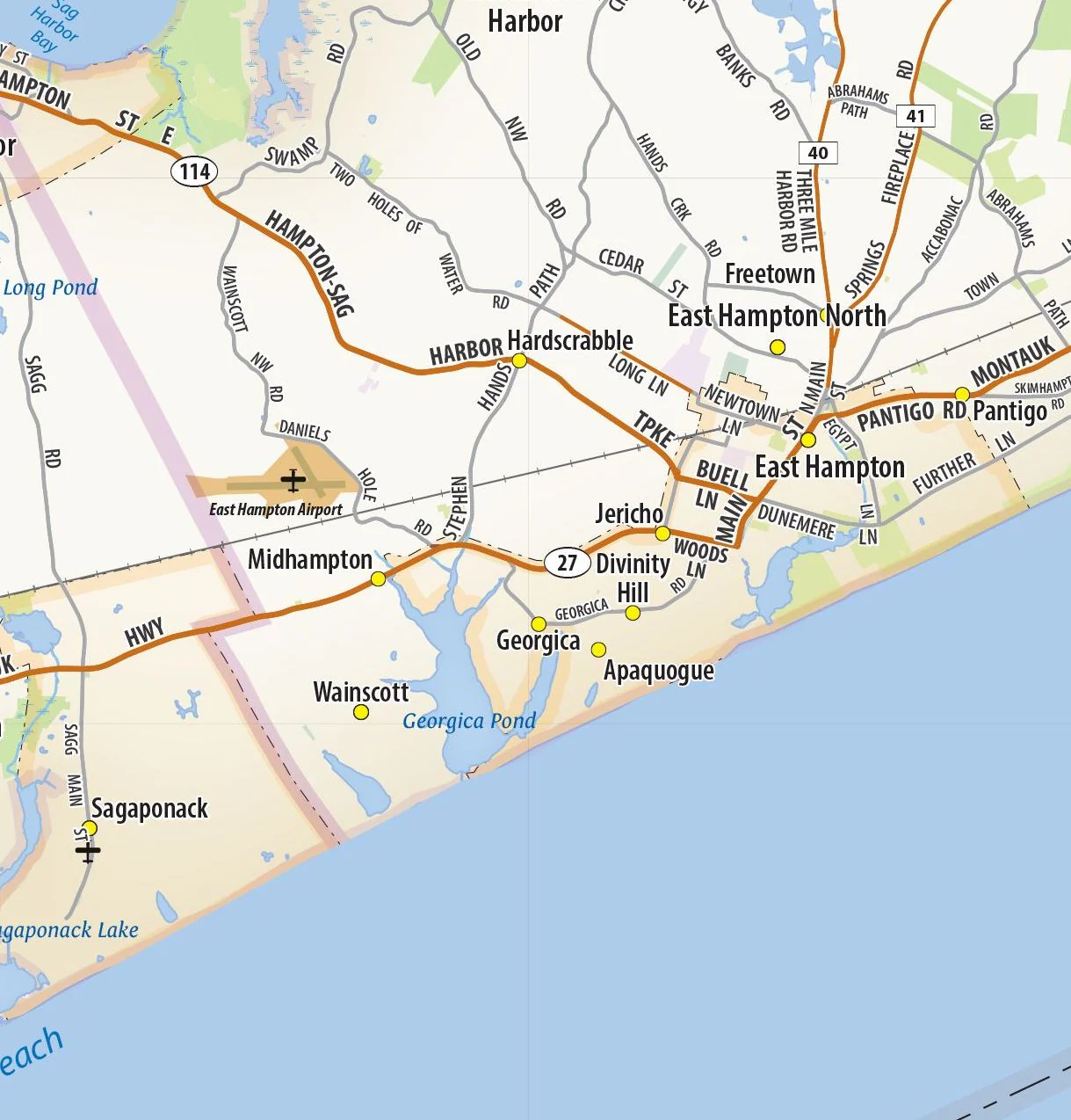
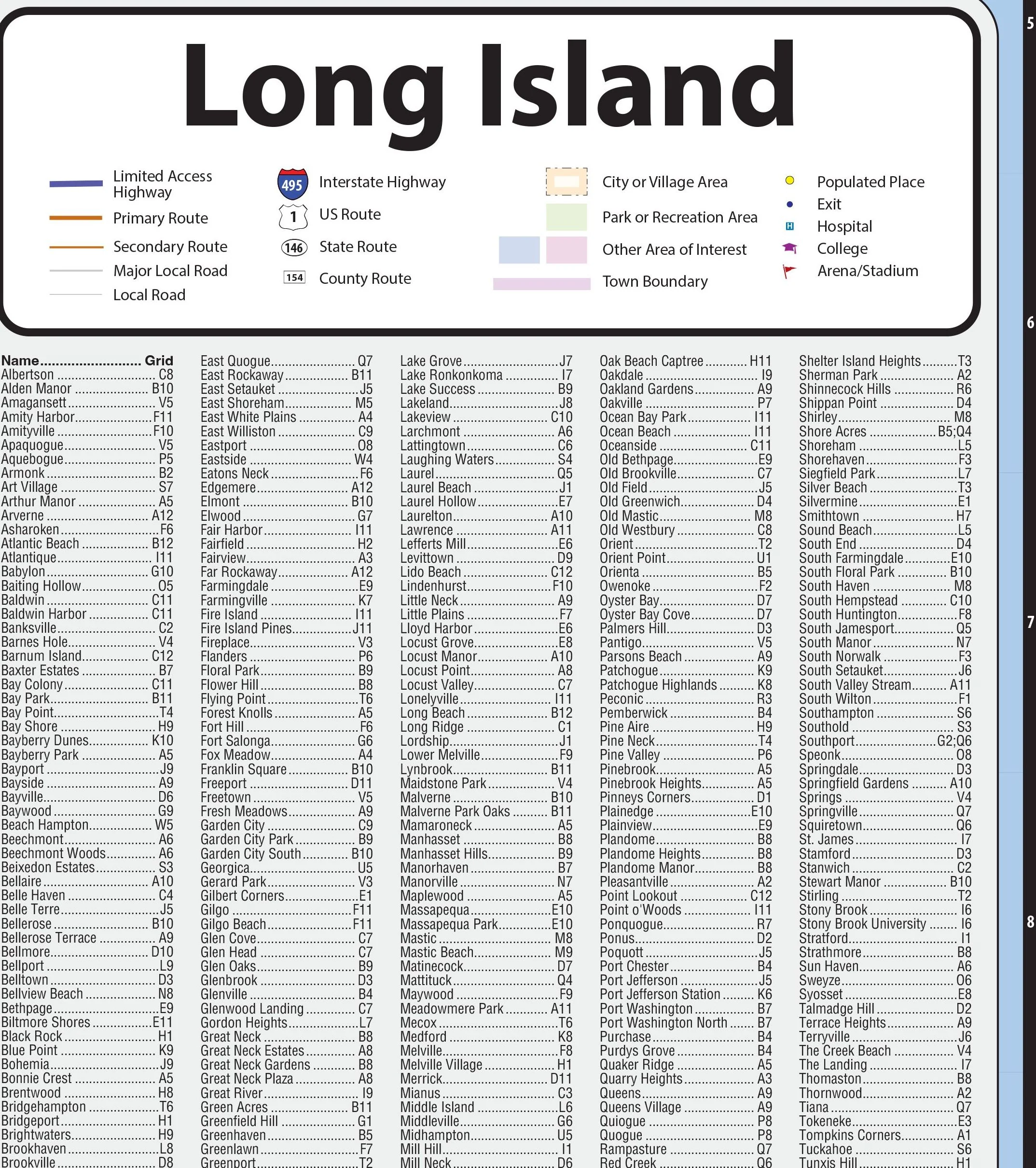
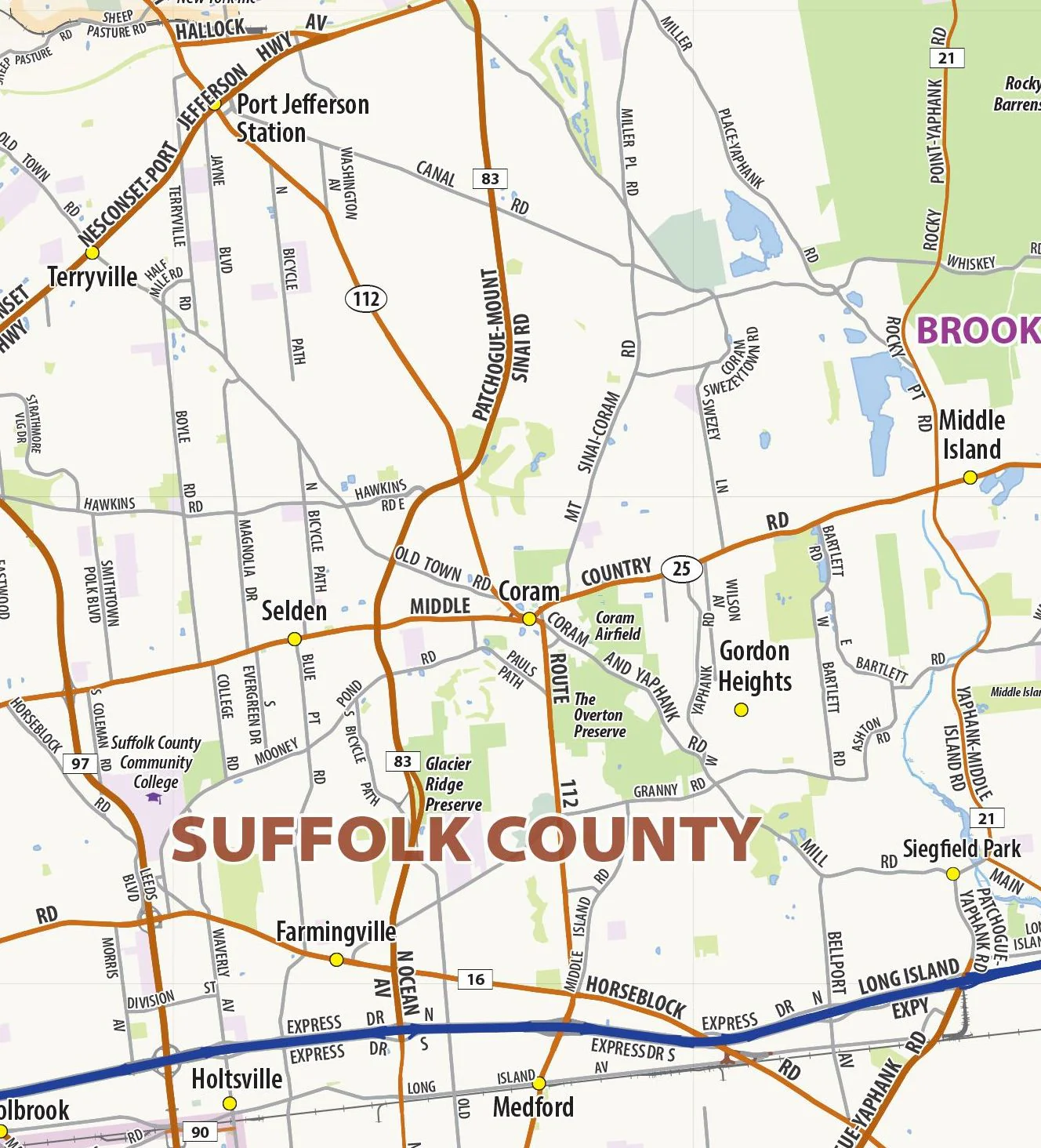
Our Long Island Wall Map shows Long Island, NY from the eastern edges of New York City (Queens) to Montauk Point. All of Nassau and Suffolk Counties are shown. The perfect tool for visualizing the big picture of this region, the map shows cities, towns, and major and secondary roads.
This map is rolled and shipped in a sturdy cardboard tube.
Product Information
Product Information
Shipping & Returns
Shipping & Returns
Long Island Wall Map
Long Island Wall Map
Our Long Island Wall Map shows Long Island, NY from the eastern edges of New York City (Queens) to Montauk Point. All of Nassau and Suffolk Counties are shown. The perfect tool for visualizing the big picture of this region, the map shows cities, towns, and major and secondary roads.
This map is rolled and shipped in a sturdy cardboard tube.
Original: $79.95
-65%$79.95
$27.98Product Information
Product Information
Shipping & Returns
Shipping & Returns
Description
Our Long Island Wall Map shows Long Island, NY from the eastern edges of New York City (Queens) to Montauk Point. All of Nassau and Suffolk Counties are shown. The perfect tool for visualizing the big picture of this region, the map shows cities, towns, and major and secondary roads.
This map is rolled and shipped in a sturdy cardboard tube.